Your cart is currently empty!
Shady Rill Recreation Area Stream Bank Restoration Martins Brook
In August 2020 Winooski NRCD released a request for bids for a Contractor to furnish all the material, supplies, tools, equipment, labor and other services necessary for the construction and completion of restoring the banks of Martins Brook within the Shady Rill Recreation Area of Middlesex, VT – as outlined in 100% Design Bid Plans developed by Watershed Consulting Associates available below. Construction will exclude coir log installation and final landscaping but otherwise will include all other components of 100% Design Bid Plans including but not limited to:
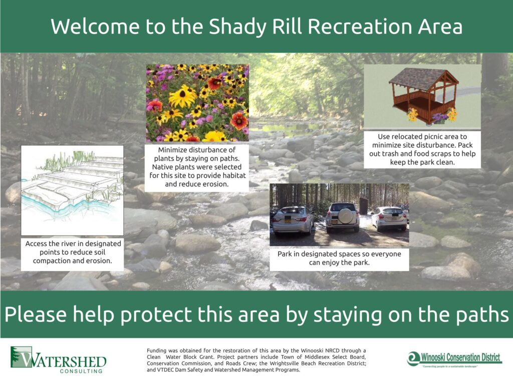
- Relocate all encroachment features including up to four grilling sites and one shelter structure.
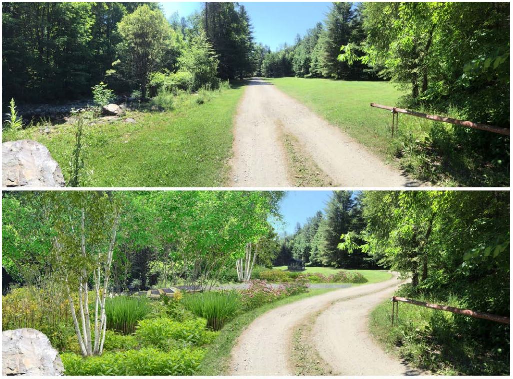
- Remove existing access drive and install new 12’ wide gravel drive in new location outside of stream buffer zone. Install new parking spaces and vehicle turnaround location.
- Reconfigure paved drive entrance and install boulders at specific locations to direct vehicle traffic.
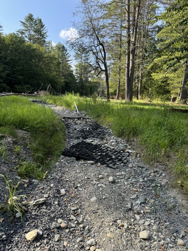
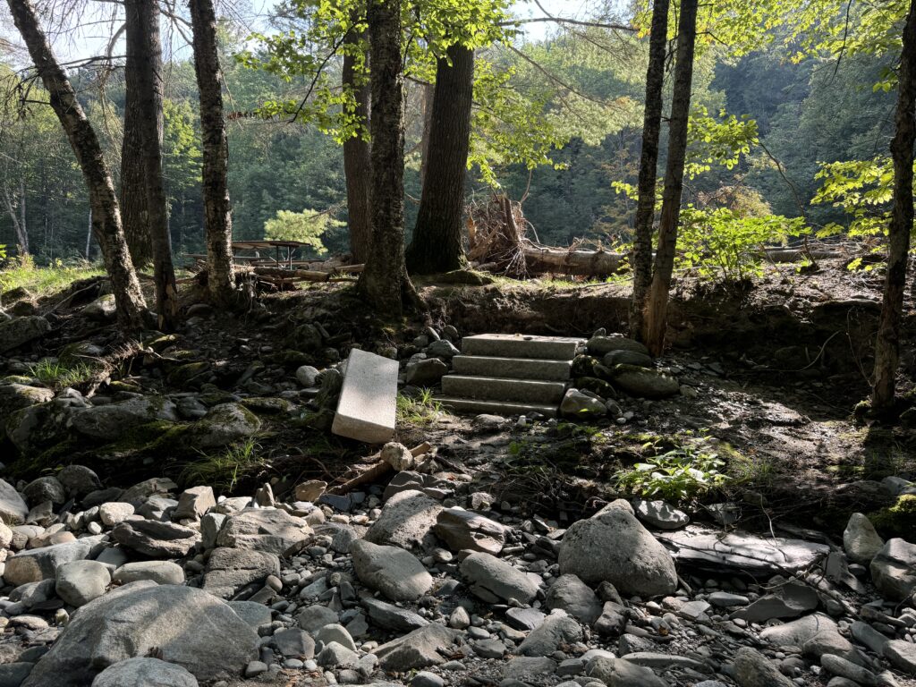
- Install four hardened access paths and three sets of stone steps into Martins Brook.
- Regrade and bench streambank in preparation for coir roll installation. Place down erosion control blankets and seed banks to overwinter.
Bidding is now closed and selection underway. Construction components will be further outlined during the mandatory pre-construction site visit. The selected contractor will be provided construction oversight by Watershed Consulting Associates who will verify completion of the project. Project faces a very tight timeline and bidders who are able and willing to complete the full scope of work by the close-out and billing deadline listed in the Request for Bids will be reviewed favorably.
About Shady Rill Recreation Area and Martins Brook
Prior to its confluence with the North Branch, Martins Brook runs along the edge of Shady Rill Recreation Area; a popular picnic spot for Vermonters in and around Middlesex, VT. The recreation area is approximately 1.25 miles north of the Wrightsville Dam and has a drainage area of approximately 12.5 square miles. Visitors to the park enjoy the picnic sites, grills, access to Martins Brook, and a mix of open and wooded areas for recreation. The park is owned by the Vermont Department of Environmental Conservation (VT DEC) and controlled by the VT Dam Safety Program.
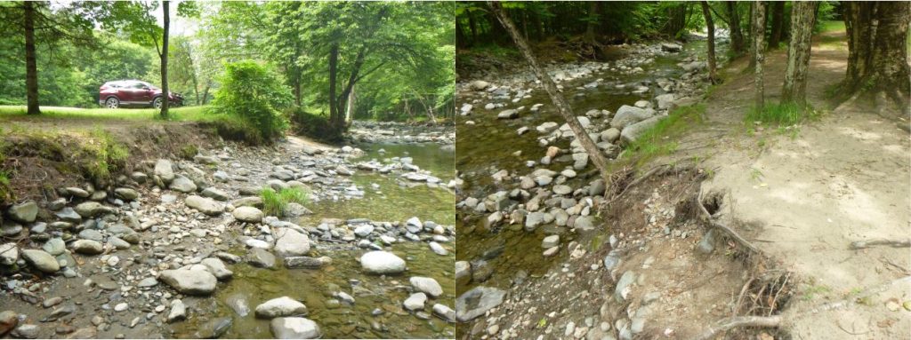
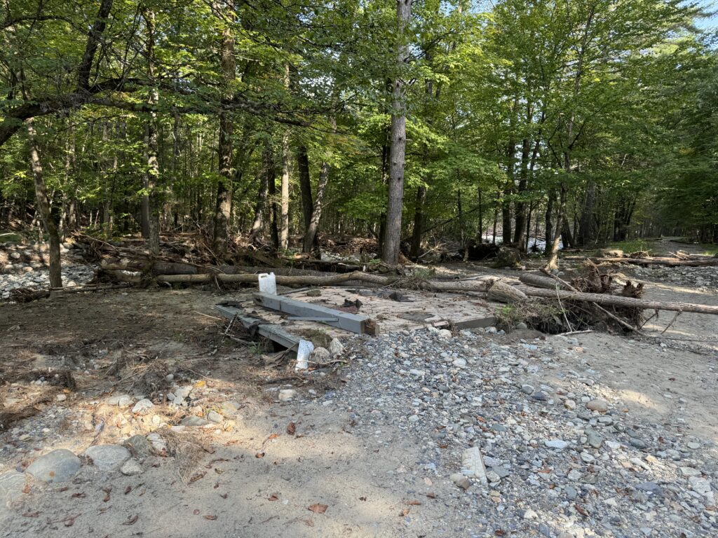
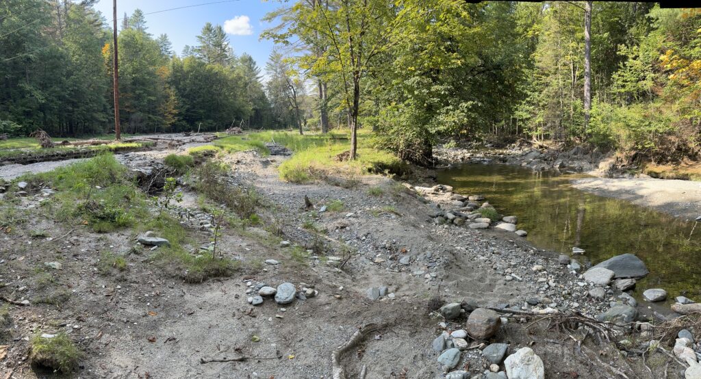
Unfortunately, the site’s access road constrains Martins Brook, and encourages visitors to park immediately adjacent to its banks. Along the reach, evidence of uncontrolled access and heavy use is apparent, resulting in compacted, unvegetated, and crumbling stream banks and significant soil erosion into the brook.
Project Documents
30% Design – Phase I – Final Report
100% Design – Phase II – Final Report
Flood Damage – Summer 2024
We were able to complete the river access but unfortunately, extreme flooding in the summer of 2024 destroyed much of our good work!