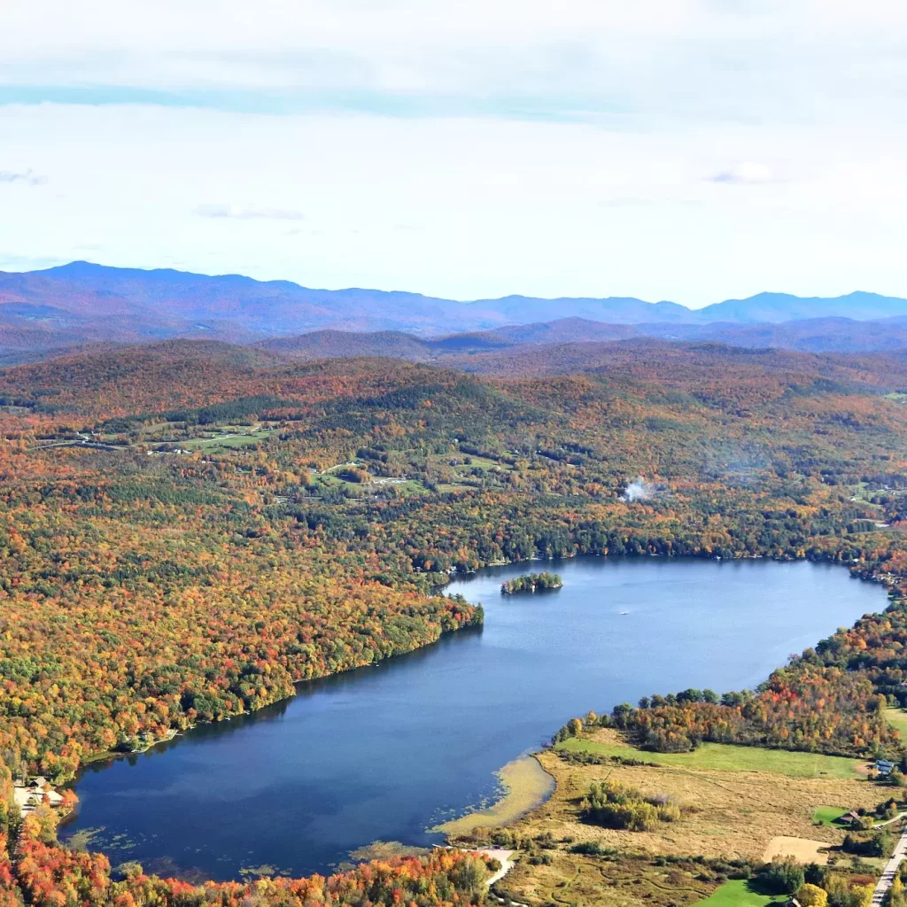
Lake Iroquois Watershed Action Plan (Completed)
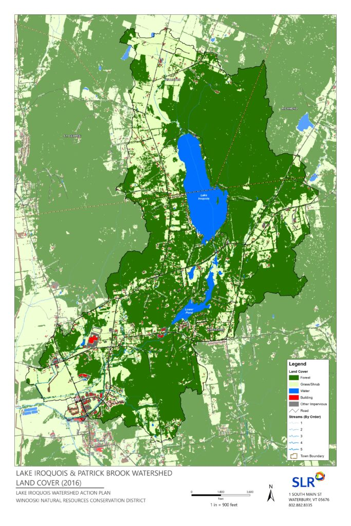
The Lake Iroquois, Sunset (Lower) Lake, and Patrick Brook complex (“the Lake Iroquois watershed”) drains almost 5,000 acres (slightly more than 7 square miles) from its headwaters in Williston, St. George, Hinesburg, and Richmond to its confluence with the La Platte River in Hinesburg, VT.
The “Lake Iroquois Watershed” is predominantly forested (60%) with sizable agricultural acreage (20%). Historic and increased development density around these water resources may be attributed to the brook’s history as a power source for town industry, and the desirability of lake frontage. As a popular recreational destination for many in burgeoning Chittenden County, Lake Iroquois and Sunset Lake have witnessed a rapid increase in visitors, a rise in seasonal camp conversions to year-round use, and upland neighborhood expansion particularly within Hinesburg. Collectively, these development pressures place greater stress on private road systems and subsequently may increase stormwater, sediment, and phosphorus runoff to the receiving water bodies.
For Patrick Brook, the development-driven increase in impervious surface stormwater runoff decreases groundwater recharge, leading to an inconsistent flow regime and stream instability. These conditions can lead to increased sediment load and elevated levels of phosphorus into Lake Champlain. From Sunset (Lower) Lake to its confluence with the LaPlatte River, Patrick Brook is listed as stressed by sediment and physical alterations with impacts to aquatic health and aesthetics caused by this development.
Currently, the watershed lacks any recent, systematic and comprehensive analysis of water quality and habitat stressors. To date, efforts to protect and restore Lake Iroquois are largely siloed from efforts to protect and restore Patrick Brook. Limited, if any, efforts have focused on Sunset (Lower) Lake.
The Lake Iroquois Association (LIA), Lewis Creek Association (LCA), and Winooski NRCD will collaborate with the Lake Iroquois Recreation District (LIRD) and other stakeholders to coordinate the development of a Lake Iroquois Watershed Action Plan (LIWAP) that will investigate sources of stormwater runoff and phosphorus pollution, distill a ranked list of projects, and develop concept designs for top priority opportunities to remediate these pollutant sources to improve water quality, wildlife habitat, and climate change resilience.
The Winooski Natural Resources Conservation District (WNRCD) has been awarded funds through the Lake Champlain Basin Program to develop a Watershed Action Plan for Lake Iroquois and the Patrick Brook watershed. WNRCD has partnered with Lake Iroquois Association (LIA), Lewis Creek Association (LCA) and SLR consulting to identify and address priority opportunities that remediate stormwater runoff and phosphorus pollution to improve water quality, wildlife habitat, and climate change resilience.
The Watershed Partners will be hosting a Stakeholder meeting on April 9th, 2024 from 10:00am -12:00pm via Zoom to review the final draft of the Watershed Action Plan for Lake Iroquois and the Patrick Brook Watershed and encourage community attendance. The partners and stakeholders will review the projects as ranked and discuss the top priority projects and receive feedback on 30% concept designs that have been created. A final list of ranked and prioritized projects has been prepared to be added to the Clean Water Projects Database. Of the 70 projects identified during the field assessment phase, four conceptual designs were prepared for rain garden projects (10% design) and five conceptual designs were prepared for stream and road projects (30% design).
In completing this project, watershed residents will have increased knowledge of their impacts on water quality and wildlife habitat. Communities will have improved planning tools and a holistic road map with clearly prioritized projects as a guidepost for design and implementation. Regional partners can then target limited funds toward high priority projects that benefit the watershed and its residents.
Throughout spring and summer of 2023 partners conducted road and stream assessments to identify projects. Stream assessments focused on evaluating: erosion of channel and embankments, riparian buffer conditions, and point features of interest including stormwater inputs and undersized culverts. These assessments identified a list of instream or floodplain restoration projects that could serve to reduce runoff and sediment loading to receiving waters. Road assessments followed the Municipal General Roads Permit Road Erosion Inventory guidance to generate a baseline of road conditions particularly across the network of private roads within the watershed and a list of road, drainage, and other stormwater improvements to reduce runoff and sediment loading to receiving waters has been generated. These assessments also looked at frequently traveled areas such as parking lots or public meeting spaces where Green Stormwater Infrastructure (GSI) opportunities exist.
During the field season of 2022 and 2023 the WNRCD worked with property owners who signed up to participate in the Lake Wise or Storm Smart programs, to identify sediment and phosphorus pollution and received recommendations for Best Management Practices (BMP). Both Lake Wise and Storm Smart protocols assessed the flow of water on a site and homeowners received a collection of clean water best management practice recommendations such as rain gardens, buffer plantings, infiltration strips, and driveway water bars that keep rain water on site and grow water-shading wildlife habitat. Typically, 3-6 projects are identified per assessment.
The WNRCD is still offering free Storm Smart assessments to help homeowners identify opportunities to mitigate stormwater damage and improve water quality. Do you have issues with erosion, pooling water or stormwater runoff? Learn more about how you can slow down, spread out, and sink in rainfall at home. Join dozens of neighbors who have already taken part by signing up for a FREE on-site assessment. Trained staff from the WNRCD will visit your home and help you trace the path water takes through your property. After the visit they will provide you with individualized recommendations to create Green Stormwater Infrastructure (GSI) solutions.
Sign up for a Storm Smart assessment at the link below:
https://docs.google.com/forms/d/e/1FAIpQLSdVl4bEMXwkIUafQUEoB0-Er8wtbVgtF365ASzbjoOqrzt4lw/viewform
If you have any questions please contact the WNRCD District at info@WinooskiNRCD.org.

“This project has been funded wholly or in part by the United States Environmental Protection Agency under assistance agreement (LC 00A00707-0) to NEIWPCC in partnership with the Lake Champlain Basin Program.”